Click to see a map of the start location.
Between Macclesfield and Buxton.
There are several car parks around the reservoir. The suggested car park is adjacent to the minor road T‑junction 400m after the sailing club on west side of the dam. OS Sheet 19: grid ref. SK 013757
From Stockport: follow the A6 to Buxton as far as the roundabout at the start of the dual carriageway. Turn right A5004 towards Whaley Bridge.
Go through Whaley Bridge town centre and follow the A5004 (Long Hill) road [A5002 on old maps] south towards Buxton for approx 7km. Look for sharp turning right at summit signposted “Goyt Valley” downhill on narrow Goyt’s Lane past Errwood Sailing Club. The suggested car park is opposite the minor road T‑junction 400m after the sailing club having crossed the dam.
From Buxton: take A5004 [A5002 on old maps] north west for 3km to summit and take left signposted “Goyt Valley” downhill on narrow Goyt’s Lane past Errwood Sailing Club. The suggested car park is adjacent to the minor road T‑junction 400m after the sailing club having crossed the dam.
Distance 2.5km, Height Gain 140m.
Descend east from start car park to re‑cross dam and then south east up to cattle grid just before A5004 [on the route driven in on].
Distance 2.3km, Height Gain 170m.
Ascend north west from start car park along The Street to Embridge Causeway to cattle grid just before junction with lane heading north to Kettleshulme.
Distance 6.1km, Height Gain 260m.
Descend south from start car park along The Street passing along west of Errwood Reservoir before climbing gradually past Derbyshire Bridge to Ranger hut. Then west to junction with A537.
Good for uphill classic ski training.
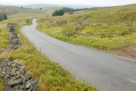
The gradients are steady but not impossible. Walking back down after the climbs is pleasant and varied [changing to trainers recommended]. The routes are all on roads but not particularly busy ones.
The tarmac on routes 1 and 2 is a little rough in parts but ok for rubber wheeled classic roller skis. Route 3 is a better surface and could be skated.
There is normally not much traffic. However it increases at weekends if the weather is good. There are a number of car parks in the area that cater for this popular walking/ biking/ picnic area.
Beware cyclists descending at great speed on routes 1 and 2.
Most of Route 3 from south west of Errwood reservoir [The Street] south to Derbyshire Bridge junction [by Ranger hut] is one way traffic [south] from 1100h – 1600h for May to September, Sundays and bank holidays.
The public convenience just north east of the dam on Route 1 is sometimes closed. The public convenience at the Ranger hut on Route 3 is normally open.
There may be a hot drink available at the Errwood Sailing Club at weekends. There are shops/ pubs/ cafes at Buxton and Whaley Bridge. The Pear Tree Café at Whaley Bridge may be worth a visit - but beware, it closes mid-afternoon in winter. The Cat and Fiddle public house on A537 is a few hundred metres west of Route 3 finish.
Details by MCCSC
Last updated 4-8-2015